
PLACES TO VISIT IN GERÊS
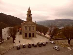
S. Bento da Porta Aberta
Terras de Bouro has one of the most important religious heritage sites, with hundreds of years of tradition – S. Bento da Porta Aberta. The cult originated with the construction of small hermitage in 1614. At that time, this chapel had a small porch and the doors were always open, so it served as refuge to all those who passed by. In April 2015, the title of Basilica was granted by the Holy See to the Sanctuary of St. Bento. This title is awarded for their antiquity and/or for being major centres of devotion and pilgrimage.

Geira Museum
It is located in the Núcleo Museológico, in the village of Campo do Gerês, the Geira Museum was built from scratch and inaugurated in June 2013, having a programme focused on Roman road construction techniques, as well as the transport used at the time. The municipality of Terras de Bouro preserves a 30-kilometre route of this old road. The museum is structured in four thematic rooms, an auditorium and cabinets for archaeological studies.

Ethnographic Museum of Vilarinho da Furna
The Ethnographic Museum is a creation manifested by the former inhabitants of the extinct community village of Vilarinho da Furna. In 1981 the municipality of Terras de Bouro started its construction, based on the use of raw material from the village. The museum was inaugurated on 14th May 1989 and is a popular architectural building in traditional “alvenaria”, whose final design fits in with the built culture of the village of Campo do Gerês.

Via Nova / Geira Romana
Geira is the name by which it is known the communication route, built by the Roman Empire, in the Flavian dynasty, that linked Braga to Astorga and that passes through the municipality of Terras de Bouro in an extension of about 30 km (miles XIV and XXXIV), because, apart from the various uses for which they were used, the most important was, without doubt, the passage of their armies, at a time when conquests were of utmost importance for the growth and maintenance of the empire. One of the most significant stretches it is in Mata de Albergaria, Terras de Bouro.

Mata de Albergaria
The Mata da Albergaria is one of the most important woods in the Peneda-Gerês National Park, consisting predominantly of a centuries-old oak grove, which includes species characteristic of the flora and fauna of the area. It also preserves a way of the Via Romana – Geira – with the ruins of their bridges and a set of milestones.
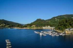
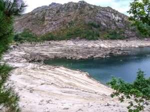
Marina do Rio Caldo / Caniçada Resevoir
The Marina do Rio Caldo and all the surroundings of the Caniçada Dam are the target of a lot of demand, either for their beautiful landscapes, or for the conditions that this area offers for nautical sports. There are almost 700 hectares of navigable water.
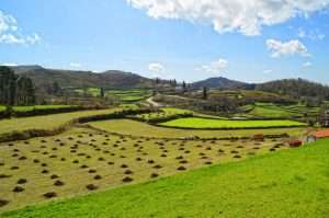
Santa Isabel do Monte
Santa Isabel do Monte is a mountainous territory where abrupt slopes descend over the narrow valley of the Ribeira de Freitas. Despite its rough and apparently “natural” appearance, it is a humanised landscape dating back to the IV and III millennia B.C., as testified by various archaeological remains. Nowadays, it sustains several population centres with a traditional agro-silvo-pastoral economy.

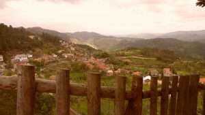
Campo do Gerês
Campo do Gerês, ancient medieval church, is located on the left bank of the Homem River, in the middle of the Serra do Gerês, and borders with the no less ancient church of Covide, with the municipality of Ponte da Barca and neighbouring Galicia. Shows excellent examples of rural mountain architecture and some “canastros” with their crosses on top, or some customary timbered balconies, open to the patio.
Ermida
Ermida is a mountain village with an important pastoral tradition, where livestock has an important value on the local economy. Around the village there are several poles of tourist attractions, such as the Arado waterfall and the Pedra Bela pointview. It is a village where strong community roots still remain.
Vilarinho da Furna
Vilarinho da Furna, in the singular, as in all official and legal documents, it is an ancient village in the municipality of Terras de Bouro located between the Amarela and Gerês mountains. Being submerged by the force of the waters after was built a dam in May 1972.